Archive for the ‘history’ Category

Old Benton Hot Springs

August 14, 2012

Most people in California have driven over HWY 120 that goes through Yosemite from Manteca on the west side of the Sierra. Few have driven the entire 152 miles over the mountains to Old Benton Hot Springs near the junction of Hwy 6 and the Nevada State Line. Nor do they know that Old Benton preceded its famous sister, Bodie, and was a full blown mining camp of 3,000 to 5,000 people in 1862.

It is hard to imagine that only thirteen years after the California Gold Rush, there were men digging holes for gold and silver all over Blind Spring Hill. The town was so large that it had its own Chinatown and flourished for 50 years.

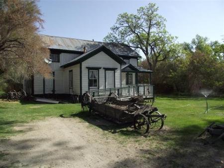
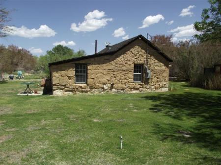
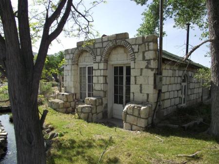
Unlike Bodie, Old Benton was never completely abandoned and exists to this day as a living ghost town. For visitors there is a general store, campground with unique hot spring tubs, and a bed and breakfast. Many buildings have disappeared but the unusual pumice stone structures remain. The entire place is totally green and heated by hot spring water. The water is so good that it is drinkable, and some swear that it is the “fountain of youth.”

I first visited the town passing through on my way to go hiking in the 1970s. I remember seeing the elderly owner, Buster Bramlette, sitting in his rocking chair watching the world drive by his front door at the old store.

Outside the screen door at the entrance was a sign that said, “Browsers not welcome!” Off to the side of the building were two Dobermans behind a chain link fence that meant business.

All was okay if one entered the store and requested to buy some beer or soda pop. Then you got to see a real life museum with pristine wagons, tons of artifacts, thousands of arrowheads and Chinese relics. There was even an old juke box in mint condition from the 50s.

In the back could be heard laughter and a big welcoming hello from Buster’s wife, Maybelle, who was the total opposite personality from Buster, who wanted to run everybody off.

The next time I went to Benton was to help my buddy, Slim, during a cattle round up in the fall. Slim kept some cattle on Buster’s pasture and would come every year to help with the roundup. After the work was done we were treated to a real old fashioned lunch at the store and ice cold beer.

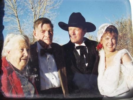
Little did I know that in future years I would work for their grandson, Bill, when he was the recreation officer on the Mammoth Ranger District in the 1980s. He was the best boss any of us ever had in the forest service, and we have remained friends to this day. When Maybelle died in 1997 followed by Buster a year later, Bill inherited the ranch and old town. He and his wife, Diane, are keeping the place intact as their grandparents would have wanted.

Buster Bramlette was born in Downey, California, and grew up with his brother Tommy and sister Lucille in Little Lake on Hwy 395. His father, Bill, was a race car driver in the teens, helped form the AAA Club of Southern California, and owned the first bank in Downey. In 1910 he bought Little Lake which has since burned down. He then purchased the Bramlette Ranch near the agricultural inspection station on Hwy 6. Finally, in 1928, he made the best purchase of all, when he acquired Old Benton Hot Springs.

Maybelle Bramlette was raised on the Kern plateau in the southern Sierra. Her father, Porter, homesteaded out there, had a sawmill, and ran cattle. When Maybelle needed schooling, she was sent down to Little Lake to be tutored. She was 14 when she met Buster, and he fell in love. He decided to hike all the way up to her father’s cabin to ask for her hand in marriage. When he got there, Porter slammed the door in his face, and he had to go all the way back down the mountain brokenhearted. Buster was persistent though and returned the next year to ask for Maybelle’s hand now that she was 15. This time he was successful and the rest is history.

Grandson Bill reminisces about how his grandparents used to send him out to watch the cows all summer when he was a boy. He had a little mustang pony named Tuffy that he rode to move the cattle to their grazing areas in Truman Meadows, Pizona and McBride Flat.

Isolation was a friend to Bill, and he later became a wilderness ranger. That started him on a career that led to becoming a Forest Supervisor on the Inyo National Forest.

Bill has a lot of great stories to tell about the people he grew up with in Benton. One of the more colorful characters was a lion hunter and mountain man named Charlie Tant, who was hired by the ranchers to remove lions from preying on their cattle and sheep. Bill said Charlie used to stuff newspapers under his clothes for insulation and would come down once a year from his cabin in the mountains to soak in the hot spring to get the newspapers off. Then he would repeat the process.

Bill and Diane, who was also a Forest Supervisor on the Modoc National Forest, have honored Buster and Maybelle’s memory by donating land to the Eastern Sierra Land Trust to hold for the public into perpetuity. This is really one of the best things they could have ever done for all of us, because Old Benton is truly a special place in the history of the West.

To learn more about Old Benton contact historicbentonhotsprings.com.

Petroglyphs of Chalfant Valley

April 12, 2012


Buttermilk and the Tungsten Hills

March 25, 2012

            One thing about visiting Bishop,California is there is no lack of recreational opportunities, whatever they may be, in every direction out of town. Not only are there excellent places to hike, but the area is popular with climbers, equestrians, Off Highway Vehicle lovers, mountain bikers, hunters and fishermen, photographers, research people and many more.

            Two areas that have become well known in recent years with climbers and OHV enthusiasts are the Tungsten Hills and the Buttermilk country.  I lump these two recreation areas together, because they adjoin each other.  The Tungsten Hills is a premier off road and motorcycle playground, and Buttermilk is the home territory of the young Boulderer, who comes from all over the world to climb there.  Buttermilk and the Chalk Bluffs on the Volcanic Tableland are the two most frequented places to climb for the past fifteen years. These two areas are totally separate from the Sierra Crest and have their own ecosystems that are high desert and fragile.

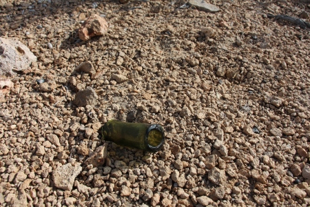
            The Tungsten Hills was an area where cowboys, sheepherders and miners roamed before the steel hardener called Tungsten was discovered and heavily mined during WWI. Not much is left of the small mining district except rusty cans, old mill foundations and broken shards of glass.  Some of the deposits that were removed created huge holes in the earth which dot the hills. 

            Near the entrance to theTungsten City Rd.is a housing area called Rocking K ranch.  This area was developed back in the 60s, and is where the elite of Bishop meet the fleet.  Such notables as Dave Mc Coy, the creator of Mammoth Mountain Ski Area, and Bob Tanner, the owner of Reds Meadow resort, built their homes there.  It is a beautiful place that they made an oasis out of in the high desert of  Bishop.

            Dave McCoy was an all around man and still is with his photography adventures and his photo blog.  One of Dave’s loves when he wasn’t busy working up on the ski hill was to ride dirt bikes with his buddies.  They would go right out of his house and actually made most of the motorcycle trails that exist in the Tungsten Hills today.  Now in his nineties, Dave and his wife Roma still venture out in the Hills in their Rhino.

            As things began to tighten down because of more riders and resource damage, BLM specified a trail system in the Tungsten Hills that includes all OHV users and all levels of ability.

            For the most part the OHV trails are sandy and travel through areas of boulders and fantastic granite rock formations.  There are few trees in that area, and it is rocky and stark with deeply cut washes.  There are small stream crossings and numerous mining sites accessed by a network of roads. Most of the really dangerous mine shafts have been fenced for public safety, but there are still some that cannot be seen until one is right on top of them. Those are the super dangerous shafts that you do not want to approach to look down or dare to let your dog near.

            From every vantage point and from on top of a knob like Tungsten Peak, elevation 5,951, the Sierra Crest looms large in the background. Mt.Tom at 13,652 feet and Basin Mt. at 13,181 feet dominate the horizon.

            All mining activity has ceased and much of it has been cleaned up by the Forest Service and BLM.  In between the maze of roads and trails one can walk for miles through strange and wonderful natural areas.

            Although the Buttermilk area off Hwy 168, not far out of Bishop, adjoins the Tungsten Hills, it is totally different and has beautiful granitic rock formations and huge boulders left over from the glaciers.  The Pinyon and Jeffrey trees with the interesting rock formations, orange and white sand, and majestic views of the Sierra all combine to make the place seem enchanted.

            Naturally, it would become one of the most popular areas in the country, if not the world, to climb boulders.  It wasn’t always so and thirty five years ago, nobody was out there, except the last stockmen and miners.  Logging had gone on in locations above Buttermilk as far back as the 1890s, and they, along with the Nevada Power Company, made the old roads.  When bulldozers were invented in the 1920s, the roads that we use today were constructed.  Before that it was horse drawn graders in places where there was no rock.  Otherwise, all the rock had to be removed by hand, and some of the old wagon roads are still intact near the housing area called Starlight.  They are really fun to follow and look for the old purple glass and cans.

            When the local Bishop climbers started writing and posting on the internet about the wonders of Bishop and what a great new area it is to climb, people came from all over like it was the new Haight Ashbury of the rock climbing world.  Many of them stayed, started climbing schools and guide services, and raised families. More climbers continue to come each year, and the place is more popular than ever with the young adults.

            What is really nice about the whole deal is that all the camping is dispersed and free.  There are numerous side roads along creeks and near meadows, like Sharps Meadow that have excellent camp sites.  It is a mix of Forest Service land, BLM, and Los Angeles Dept. of Water and Power, and unless it says no camping, it’s okay.  All that is needed is a California Campfire Permit which can be obtained at any forestry office and is good for a year.  Since Buttermilk is in the foothills of the Sierra, it snows less and is warmer.  People climb out there most of the winter, but summer is just too hot. At that point everyone has to retreat up high into the mountains.

            For the hiker these areas offer many places to explore far from any of the other user activities.  Many spots have burned in the last thirty years, but in between, are dense patches of brush that are difficult to walk through.

            The area has many springs and sloping meadows where cattle grazing once dominated.  Creeks cut through deep canyons filled with immense Jeffrey trees and Cottonwoods.

            Evidence of Native Americans is everywhere to be seen in the form of obsidian flakes left over from ancient hunting forays. 

            Small pockets of hard rock mining are tucked away and hidden in odd places one would never expect.  Some mining sites they packed mules up to and blasted to create a shaft.  Other sites were accessed by bulldozer from the 30s until the 70s, when mining on the Inyo National Forest began to become more restrictive.

            When one looks up at the Sierra Crest from Buttermilk, old mining roads that the bulldozer operators made are visible in incredibly steep places.  Those men were truly fearless, but accidents did happen, and some lost their lives.

            Next time you are cruising Hwy 395 through Bishop, drive upWest Line St.about 8 miles to the Buttermilk turnoff.  The Tungsten Hills can be reached off Ed Powers Rd, about 5 miles north of Bishop.

            Every now and then the residents of Bishop are treated to a spectacular show during storms when the Buttermilks are lit up with sunlight and a rainbow, while everything around them is dark and foreboding.

Images of the Volcanic Tableland

February 10, 2012

Ten Best Campgrounds in the Eastern Sierra

June 16, 2011

How we all long to get away from it all and go camping. It is so ingrained into our national psyche that the phrase, “Happy Camper” denotes whether we are doing well or not.

When kids grow up to be adults they always remember those times out camping with the family, if they were so fortunate to do so.

It is the place that is remembered where one can go to re-create himself or herself in the midst of the American recreation world of fun.

That is why there are generations telling stories about camping experiences and how they came back to the same places all of their lives often bringing children and grandchildren.

One of those favorite places to recreate is in the Eastern Sierra of California that affords both desert and mountainous terrain to explore.

It is an impressive land called Inyo by the native people meaning, “Dwelling Place of the Great Spirit.” And indeed it is with its radical escarpment, giant peaks and volcanic-glaciated terrain.
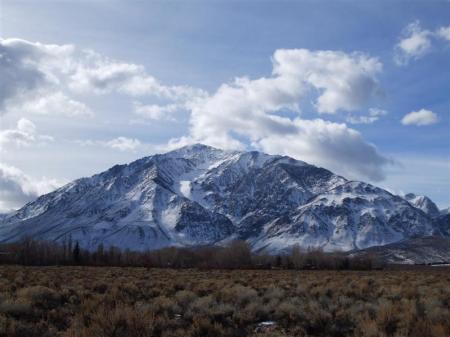
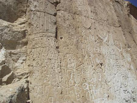
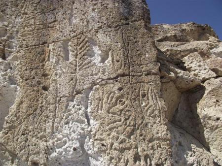
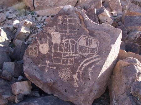
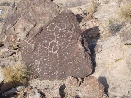
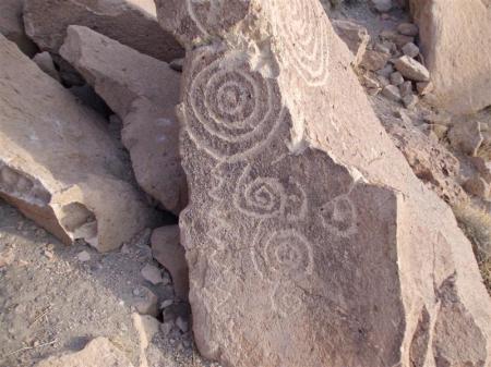
It is also a land where ancient spirits roam places like the Volcanic Tableland, ten miles north of Bishop, where petroglyphs and signs of human habitation for thousands of years are evident.
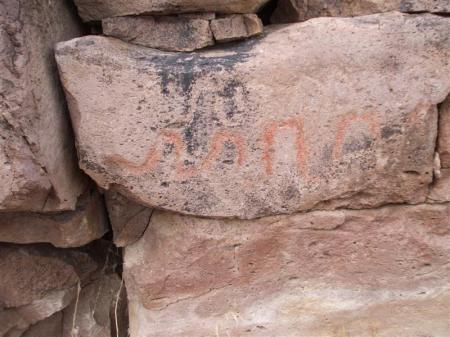
The list of activities is endless in the Eastern Sierra ranging from: camping (developed and dispersed), hiking, biking, equestrian and mule packing, OHV (Off Highway Vehicle), fishing, hunting, boating, scientific research, birding, rock climbing, hang gliding, soaring, golfing, snow skiing, exploring and many more.

While doing any of these wonderful activities one needs to know where to camp and what the top ten choices for campgrounds are for starters. Then you can search further and find other nice spots. So, here we go starting from the south end of the Inyo National Forest at Lone Pine heading north toward Bridgeport on the Toiyabe

1. Horseshoe Meadow:
One of the few remaining forest service run campgrounds left on the Inyo. All the others went to private concessionaires years ago, and they charge $23 now.

Horseshoe is still a great deal at $8 per night and is walk-in only. There are two separate campgrounds at the trailheads for Cottonwood Lakes and Cottonwood Pass. There is also a ten unit equestrian camp that is one of only two on the Inyo. This camp is very popular with the backcountry horsemen and equestrian folks from So Cal.

Mt Whitney hikers stay at Horseshoe overnight to acclimate before their ascent the next day, because it is at 10,000 feet.

The drive and views up the road to Horseshoe Meadow are incredible. Walt’s Point, high up the road, is a favorite hang gliding take off spot. The high elevation, immediate entrance to the Golden Trout Wilderness, and outstanding scenery make Horseshoe Meadow a prime camping location for those who live close to the Southern Sierra.

2. Onion Valley:
The Sierra gains magnificent heights out of the quaint little town of Independence and over Kearsarge Pass. The drive up is as spectacular and breathtaking as the Horseshoe Meadow road past older closed roads that go to defunct mines.

The campground at Onion Valley is small but still retains its old days charm with nice, new bathrooms.

Onion Valley is a fine riparian area with streams and springs bubbling up all over. Everything out of the campground is straight up and gains expansive views of the Owens Valley.

Not far from Independence is the Sawmill Trailhead and Division Creek power plant. This is a real nice area to disperse camp for free.

The usual rule for dispersed camping, which is everything outside of the developed campgrounds, is try to use an existing fire ring, and make sure to have a California Campfire Permit, good for a year and available at forest service and forestry offices. Always pay close attention to fire restrictions which are usually posted along all the roads.
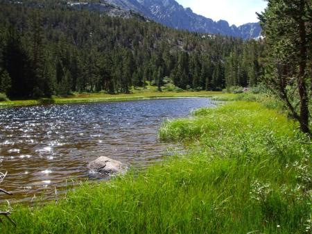
3. Goodale-Taboose:
These BLM campgrounds are grouped together, because they are so close to one another. They are low elevation camps in the Owens Valley along creeks with thick brush and lava flow formations.

Taboose is a tuber that the Paiute people ate and actually irrigated. It was one of the first forms of irrigation the settlers saw when they moved into the valley in the 1860s.

The Taboose Pass Trail is famous for being a real heart rate experience. The first two miles trudging in soft sand and no shade up to the first creek is killer when it is hot.

There is just no let up in that trail all the way to the pass, when one encounters large fields of obsidian flakes left by the ancient Trans-Sierra traders.

One of the marvels of this area in spring is the vast fields of Mountain Lupine which grows in areas previously burned by fire.
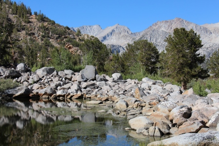
IMG_1424

4. Big Pine:
Home to the Palisade Glacier, Lon Cheney cabin, entrance to the Bristlecone Pine Forest and Westgaard Pass, the only highway through the White Mountains.

All the campgrounds in Big Pine Canyon are nice. The one up where Glacier Lodge used to be is probably the best. There is a nice little pack station by the campgrounds, too.

Big Pine Canyon is laid back and very different than its neighbors to the north. Yet, it has some wonderful areas to hike that cater to every ability from beginner to expert. Nice waterfalls and lakes abound on all the trails up there.

There is even an upper walk-in campground that they used to drive to years ago. It is a short, steep hike from the trailhead at the end of the road.

On the north fork trail is the Lon Cheney cabin that the actor had built in the 30s and still stands in perfect condition today.
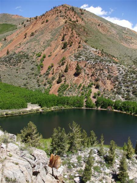
5. Bishop Creek Canyon:
Most people traveling along Hwy 395 are on their way to Mammoth and not as many venture up into Bishop Creek Canyon or the more remote OHV areas in the Coyote Mountains.

With three lake destinations, Bishop Canyon is loaded with campgrounds from Bitterbrush at the lowest elevation to North Lake at the highest.

Bishop Park is one of the nicer ones near the popular fishing spot, Intake II. Most of the campsites are right along the creek in the big Jeffrey Pine trees.

One of the most beautiful camping areas is Table Mountain Group Camp. This is a walk-in with its own meadow, stream and fine, tall mountains rising up from it. Few campgrounds attain this type of splendor.
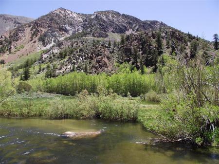
Group camps are the best deal going for five to twenty five people. The cost is affordable when split by the group, and they get their own campground reserved just for them. It doesn’t get any better.

6. Rock Creek Canyon:
On the way to the Rock Creek Lake junction at Toms Place is Pine Creek Canyon. There are no campgrounds there but some excellent dispersed sites along the creek.

Pine Creek was home to the Union Carbide Mine, now defunct, and has a pack station that covers some of the most rugged and beautiful mountains in the Sierra.

Rock Creek Canyon is number one on the best place to go and camp in the Eastern Sierra. It, too, has a multitude of campgrounds, lodges and western scenery at its finest.

French Camp (7,000 feet) is at the entrance to the canyon and is at a much lower elevation than Mosquito Flat (10,000 feet) at the end of the road where the trail to Little Lakes Valley begins.

Mid way up the road are perhaps the nicest little campgrounds at Upper and Lower Corral. The old lodge and cabins are there near the campgrounds in the thick of the Lodgepole trees.

The meadow and views of the mountains at the end of the valley at Upper Corral are incomparable. The whole area is just like a beautiful Japanese landscape garden with sand, boulders and ancient Juniper trees.

Some of the best hiking is to be had in all the side canyons of Rock Creek including the Tamarack Bench and Hilton Lakes.
7. Mammoth Lakes:
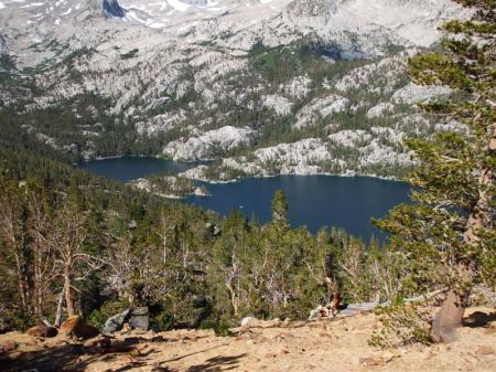
If Rock Creek is the nicest area to camp, then the Mammoth area is definitely runner up. Campers like it, because it has the Lakes Basin and Reds Meadow for camping and the town for all the amenities that a large ski resort would have.

Reds Meadow is spectacular with the Devil’s Postpile and numerous campgrounds along the San Joaquin River.

At the end of the road is the Reds Meadow campground, nearby store and Mule House Café. Buses are running all day long, and it is easy to get around in the valley.

Reds Meadow Campground is still like it always was in a semi-primitive state but with nice bathrooms and flush toilets. All the campgrounds in the valley are cozy, but Reds Meadow, with its nearby hot spring bath house is the best.

Agnew Group Camp is the other good choice in the valley. It is set way back in an absolutely superb area with huge Fir trees and very private.

8. June Lake:
June Lake is like the little gem of the Eastern Sierra without the visitor pressure that its sister Mammoth gets 20 miles to the south. There are Silver, Grant, Gull and June Lakes in the loop and many campgrounds to choose from.

Oh Ridge Campground at the entrance to the town is a good one and has its own little beach with the bluest, coldest water. The word for this place in summer would have to be “refreshing.”

A lot of wealthy, famous people hung out in June Lake in the 30s and 40s. Walter Lantz and Frank Capra had summer homes on Millionaires Row at Silver Lake. Clark Gable, Carol Lombard and all their friends used to pack up to Little Hollywood on Gem Lake to hunt, fish and party.
No doubt about it that June Lake has the most charm of all the towns in the Eastern Sierra.

There are many free campgrounds around June Lake like Big Springs, Deadman, Glass Creek and Hartley Springs to the south.
Walker Lake trailhead to the north is really nice now since they fixed it up with nifty little camp units.

9. Lee Vining:
This is the gateway to Yosemite and perhaps the most popular junction in summer. It also has ancient Mono Lake and many a photographic moment in every sunrise and sunset.

Nearby, the Mono Craters are a reminder of the cataclysmic forces of nature that have shaped the Eastern Sierra. And in the mountains of the Sierra are the polished granite surfaces left from the glaciers that carved it.

That is why everyone heads for Saddlebag Lake Campground to get close to Yosemite and the Range of Light.

A little side trip that is highly recommended in between June Lake and Lee Vining on Hwy 120 East is Old Benton Hot Springs. This town is the next best thing to its cousin Bodie up the road and has a history that equals it with the mining that went on at Blind Springs Hill in the 1860s. Each campsite in the town has its own hot spring tub. It does not get any better than sitting in one of those hot tubs and looking up at Boundary Peak, the highest point in Nevada.

10. Lundy, Virginia Lakes, Green Creek:
These areas on the northeast end of Yosemite National Park are rugged, loaded with history and superb in their own right. There are not many developed campgrounds out there and that is the way they like it on the Toiyabe National Forest.

Lyin’ Jim Townsend, the famous pioneer journalist, called Lundy home for awhile. He created a big bonanza fictional town in his newspaper complete with scandals, murders, and corruption to influence would be stock investors in London. It worked!

Virginia Lakes is an area of shale and volcanism like most of the Sierra. I found a Spanish style arrastra there years ago off the trail where they used burros to grind ore by making them walk around in a circle, dragging a heavy rock.

Green Creek is really mellow like Virginia Lakes and Lundy Canyon. It is near the Bodie turnoff and is steeped in history with one of the first dams for a power plant operation.
Well, that about covers all that I can share with you about camping in the Eastern Sierra from my many years of living there.

What you need to do before you go camping is check out the appropriate websites to find out the opening/closing dates. fees, and whether reservations are required or not.

Some camps are still first come-first served, and you can find that out on the websites as well.

Remember this, my camping friends, “Families and friends who camp and hike together, stay together.”  Happy camping!

Owens Valley Petroglyphs

January 4, 2011

Sky Rock:  Photo by Mikhail Rezhepp

hunting blind

Arborglyphs of the Eastern Sierra

March 29, 2010

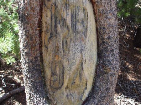
It was purely by chance that I stumbled across one of my greatest discoveries in life, the arborglyphs of the Eastern Sierra. I started out hunting for pioneer and Indian relics as a young boy and was fascinated by the history of the West. I still go back to those boyhood days every time I go out exploring with my dog. It makes me feel like a school kid on Saturday morning.

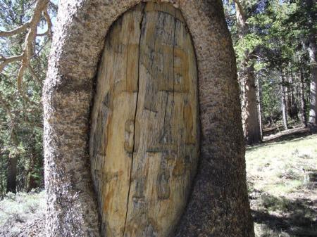
I walked by the silent tree carvings for twenty five years not knowing they were there watching me from their tree trunks. Then, one day while eating lunch in the meadow at my favorite spot on the Tamarack Bench at Rock Creek Lake, I noticed some small pieces of purple glass and a Levi Strauss button on the ground. Looking up in the trees I noticed some carvings. Then, on a downed tree, I saw a date of 1892. I was so excited and amazed at this find that I began to research and explore the entire area for new arborglyphs. It became a passion as I morphed into a full on glypher. I now live to promote their value as important historical cultural treasures from our nations past.

There really are no records about how long people have been carving on trees. The types of people who would have left their mark in the American West included: trappers, explorers, settlers, stockmen, Indians, surveyors, miners, woodcutters and the cavalry.

I learned that the carvings on the Tamarack Bench were mostly from Basque sheepherders with the possibility of an Irishman thrown in for good measure. They were the ones who came to America in the Gold Rush of 1849 and started the sheep range business all over the West. By the 1880s they worked their way over to the Eastern Sierra and started a green gold rush of their own by grazing every mountain meadow they could get their hooves into. When those meadows were wet, they left devastation in their wake that will take hundreds of years to recover. That is the dark side of the arborglyphs that we admire today.

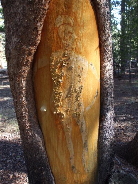
It’s lucky for us that pioneers left their mark on the trees around the meadows where they grazed their stock. It is all that is left to represent their entire life time. Upon looking at their graven images one can relate to their human desires of a lonely heart searching for love, companionship and sex. Some left entire last names like Lombard, Juillet and Bresson, as well as dates from the 1880s to 1896.

This was during the Victorian era and the carvers were careful not to show any nude depictions of women that would become so common with the pornographic images that future shepherds would carve as societal morals decayed. On the other hand the shepherds thought it perfectly okay to depict themselves naked with a large display of their manhood. Another common theme was a top hat, smoking cigarettes or a pipe. The women of their day are depicted with bustles, bows and bizarre hair.

Grazing activity reached a peak in 1896 in the Eastern Sierra and continues to this day with shepherds from Peru and Chile. Every year they leave their name and date on the trees where they work.

After finding those original glyphs on the Bench, I went on to find many more images in Rock Creek Canyon and Bishop Creek Canyon. I have no idea how many more are out there. That will be left up to the future glyphers of America to discover and wonder about.

Arborglyphs on aspen trees number in the tens of thousands. The carvings on lodgepole trees on the Tamarack Bench are far more rare and in their own class for research. In fact, arborglyph experts like Chris Worrell from Ohio have verified that these particular glyphs are a national treasure.

One summer I returned to the groves of arborglyphs on the Bench and found a new trail running through the area that the commercial mule packers made to pack in fishing parties. They were in a battle with the environmentalists and the forest service to increase stock use in the Eastern Sierra wilderness. They chose to increase their use by camping just outside the wilderness boundary in the exact spot that the arborglyphs are located. This was all very upsetting for me and I contacted the forest service, environmentalists, wrote editorials and talked to many people about it. For political reasons the forest service would not respond because of the lawsuit.

The lawsuit lasted eight years and the forest service was finally defeated in the Superior Court of San Francisco. This was after they spent $7.5 million on a failed wilderness plan designed to increase commercial stock use. That whole ordeal left the packers angry to this day. Nothing ever changed on the Bench and the same trail runs through there as a permanent fixture.

On the positive side, during the lawsuit, teams of specialists were sent out to survey the wilderness and among them were archeologists. They recorded many of the arborglyphs on the Bench which were placed on a map in case of fire.

Many of the arborglyphs are fading away due to weather erosion. The bark has worn off, and the knife lines are disappearing into the golden color of the elderly lodgepole trees. Some of the trees have blown down with their carvings facing the ground never to be seen again. One carving from 1896 was blasted by a careless individual with a shotgun. They also threw an axe at it for target practice. Even pesky woodpeckers and beavers can do a number on arborglyphs.  The worst enemy is fire.

So like Chris Worrell always says, “Photograph, document and record,” before the arborglyphs fade away forever. This is our window of opportunity to provide future arborglyph researchers with the images they may never be able to see in the wild. Next time you are out wandering in the woods, take a look around at the trees to see if they have any stories to tell you. Don’t leave home without your camera and have fun glyphing.

Old Wagon Roads of Sherwin Grade

March 28, 2010

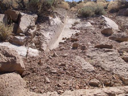
To stand down at the bottom of Sherwin Grade on U.S. 395, some 10 miles north of Bishop, California, and look up is impressive. Cars and trucks zoom by at high speeds and accomplish in 10 minutes, what it took pioneers in wagons an entire day to negotiate. Huge wagons weighing tons ground their way up and down the volcanic Tuff rock leaving a permanent mark in history with their deep ruts.

There has been a progression of about five or six different roads up the grade to get to where we are today. One of the first roads was for logging made by James L.C. Sherwin in 1870. The logs for lumber were cut at Swall Meadows, known formerly as Sherwin Meadows. and hauled down to a sawmill at Rock Creek Canyon. They dammed up the creek and made a large pond in which to float the logs. In 1879 Sherwin built what was called the High Road through Rock Creek Canyon, Long Valley and Mammoth City. This toll route ran by the old ranger station at Witcher Spring to Rock Creek Station, Little Round Valley, Whiskey Creek, McGee Meadows, Laurel and Sherwin creeks, and Mammoth City.

Sherwin’s grandson Fred Brooks used to recall, “My grandfather, James L.C. Sherwin, came to Round Valley in 1866. I used to go with my grandfather on his trips to Mono Mills and Bodie when I was a boy, that is, when we could get through.” Sherwin brought his wife, Nancy, and two daughters, May and Nannie, from Virginia City, Nev., where they had arrived from back east in 1859. He chose to build a home on beautiful Rock Creek, bordering the Inyo-Mono county line, and grew wonderful produce and fruit.

When deep snow closed the High Road, Sherwin built another road to the east called the Dry Road that started at the old Roberts Creamery just below the county line. Sherwin employed a lot of the local Paiute Indians to help with all kinds of labor from digging irrigation ditches to building roads and farming. There was never a shortage of labor or a means to make a living for anyone at that time.

I have walked all the old wagon roads in their entirety from the bottom of Sherwin Grade to Sherwin Summit and Tom’s Place. The roads are about 10 miles long and average 3,000 vertical feet.

The Dry Road is the most outstanding example of a historic wagon road to be found anywhere in the West. It remains so because nobody has traveled on it since the 1970s, when the four-lane highway was built and freeway fences closed off all access.

At the top of the grade where it comes out on the Los Angeles Department of Water and Power Gorge Road, rock slides have closed it off, and very few people know where it is anymore. It crosses the new highway at the bottom and midway up. Most people drive right by a short section that runs throught the median and never see it. Yet, there it is after 140 years. The road parallels the new highway to the west for about five miles and goes through a half mile stretch of solid Tuff rock with deep ruts. This is very noticeable from the air. The ruts were formed when the heavy wagons braked and ground their wheels into the rock. Some of the ruts are up to two feet deep, and the wagons could not get out to pass another oncoming wagon. They had to look ahead, listen for the bells and try to find a place to turn out with the big teams. As you can imagine, it took a lot of cussin’ on the part of the muleskinners to get those animals to respond.

They were out there in all the elements of extreme heat, cold, snow and blow with nowhere to hide. They had to put their head and hat into the wind and take the brunt of it. It was tough business to be a teamster in those days. It was hard on the animals and the men, but the goods had to get through to the mines and towns along the way. The High Road was the route used most often and also has many deep rutted sections in the solid rock. Near the turnoff to Swall Meadows the road is visible right off the highway. It actually crossed the old Rock Creek Road in two places before dropping down into the Gorge. Mountain bikers now use the old wagon road as a trail that starts at Swall Meadows and goes down to Paradise.

It is really hard for us to conceive today what the experience of traveling the old wagon roads was like. From the idyllic ranches and stage stops of Round Valley to the lush meadows of Long Valley and Sherwin Creek, the buggies, small wagons and large freight teams of 18 mules labored along. All that is left now is a few historic buildings and the ruts in the road. They will tell a story for centuries to come of a unique time in our western history along the old wagon roads of Sherwin Grade.

Since I wrote this story I have found the original High Road and Dry Road that predate the heavily used wagon roads.  They quickly abandoned old sections for easier ways to go, and the original roads are really going back to nature.  It turns out there were more roads and passing lanes than I originally thought.  The associated artifacts along these first roads indicate a period of time during the 1860s.

IMG_1603

Chuck Yeager Arborglyph

March 28, 2010

Mono Lake Memories

February 25, 2010

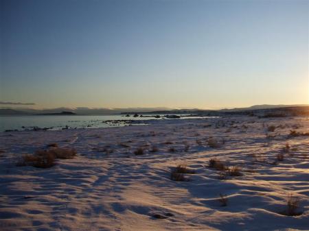
Over the years I have observed Mono Lake in the Eastern Sierra from every shore in every kind of weather-from the mirror calm of a bright orange sunrise to the violent churning foam of a turbulent, green sea. And always, the choking alkaline dust blows on the east side of the lake creating great clouds of toxic dust. Mono Lake is ever changing and provides a lot of life from such an ancient dead sea.

Paiute people harvested the high protein fly larvae that were wind driven onto the shore in great piles. In all the surrounding hills were pine nut trees and large game, while along the streams, riparian plants flourished. The islands provided an unlimited supply of sea gull eggs and birds to hunt. In summer, the door was open to the Sierra backcountry for the people to return to like they had for centuries. Back and forth they would go following the trans-Sierra trade routes or fleeing the cavalry in historic times.

John Muir thought Mono Lake was quite a sight when he came over Bloody Canyon from Yosemite and saw it for the first time. He complained about how dirty the Indians were in such a clean environment. Mark Twain had a whale of a time when he got caught in a storm on the lake and barely made it to shore. He had a lot of nasty things to say about how the water in the lake would peel off skin, but the lake was actually a popular water ski spot in the 60s. You know how Twain liked to exaggerate.

Every shore around the lake has something different to see and experience. To the south are the Tufa Towers and large, thick stands of sagebrush that grow beyond the sandy beaches. In the spring the no see ums can make life real unpleasant in the six foot tall, 150 year old sagebrush. Without a hat the little devils will get into your hair and bite your scalp in a hundred different places before you can reach up to scratch the itch. A day without a breeze during May-June when the no see ums are out is a good time not to be there.

The south side of the lake leads down through vast fields of white pumice to some awesome volcanic examples called the Mono Craters. These craters are really fun to climb and run down the steep, pumice slopes. Now that the motorcycles aren’t ripping everything up in the craters anymore, the area is returning to its former smooth and sandy glory. Riding motorcycles in the craters at high speed was fun while it lasted, but those days are over.

Another interesting historical site on the south end of the lake on Hwy 120 is Mono Mills. Men were all over the country cutting huge Jeffrey trees to be gathered at the saw mill for shipment by train to the mines at Bodie. It is still possible to walk sections of the railroad grade where the ties are left rotting on the ground and old cans and broken glass lay scattered about. Some spots had short trestles. This was another project where Chinese labor was employed to negotiate the steep grades required to get up the hill to Bodie.

The east side of the lake is mostly four wheel drive because of the thick, soft pumice on the old railroad grade. There are Pinyon pine trees but not much evidence of previous inhabitants. They seemed to like the north and west shores better.

Always in view are the mysterious volcanic islands that are stark but have a magnetic quality that entices the visitor to want to go out there and explore.

The north side of the lake has sand dunes with a scattering of Pinyon and Juniper trees leading up to the hills where the Indians gathered nuts in the fall. There are springs and small creeks that draw more wildlife than in other parts of the lake. On the northwest part of the lakeshore are immense hills of black pumice that have been mined for road cinders and other uses for many years. A lot of sheepherding has gone on in this area from the 1890s to the present day.

The west side of the lake is where most of the activity occurs where the highway runs at the base of steep mountains that lead into Yosemite. The old store called Hammonds and other historical buildings are still there. The town of Lee Vining remains an important tourist stop for visitors along Tioga Pass and Hwy 395.

High above the lake are many mines. Some have roads to them like the Log Cabin Mine, but others are reached only by hiking cross country or on old trails. The Mono View Mine from the 1890s is one such place that has a spectacular view of the lake. This was one of those places where everything had to be packed in on horse or mules a couple of miles up the steep, tree-lined hillside.

In the 1980s I had the opportunity to meet a gentleman who reclaimed the Mono View Mine and made a trail to get his little dirt bike up the hill. He was in his seventies then and was actually working the mine in summer. There was nobody tougher and more highly skilled than the old prospectors and miners who walked the mountains and deserts long before anybody but the Indians.

There is a wealth of history that Mono Lake possesses even to this day after the area was saved from being drained by Los Angeles. Since Dick Dahlgren of Cal Trout caught a fish in Rush Creek that wasn’t supposed to be there to people transporting water on their bicycles from Mono Lake to LA, more people have come to realize the importance of this ancient sea with its high, wave cut terraces and stark beauty. The local bumper sticker says it all, “Long live Mono Lake!”